

Tenerife’s GR131 Volcano Traverse: What Seven Days Crossing the Island On Foot Actually Involves
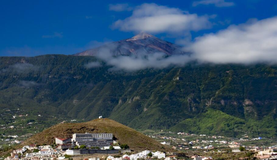
Most people know Tenerife for its beaches. Fewer know that the same island holds Spain’s highest mountain, a national park with genuine UNESCO World Heritage status, and a network of centuries-old trading paths that still cross its mountainous spine today.
The first two days lead you upward through cool pine forests—the kind of immersive walking where the canopy keeps the sweeping views a secret. Then suddenly, the forest simply ends. Stretching out ahead lies a volcanic plateau the size of a small country — sparse, grey, and silent — with the dark cone of Mount Teide standing over it all, on an island best known for its beaches.
That contrast is what this trip is built around. A part of Tenerife that most visitors never see. A week on the GR131 takes you from lush pine forests above La Esperanza in the north, over Spain’s highest mountain, and down through quiet highland villages to historic Arona in the south.
This guide covers what a week like this actually involves: where you walk each day, how hard it really is, and the long history written into the ground beneath your boots.
What the GR131 Actually Is
Tenerife is home to the Teide National Park, which this route crosses at its highest point, and has held UNESCO World Heritage status since 2007 — a genuine international recognition, not just a tourist-board claim. Mount Teide itself reaches 3,718m, the highest point in Spain and the highest point on any island in the Atlantic. Measured from the seabed, it is the third-tallest volcanic structure on Earth.
The GR131 itself isn’t unique to Tenerife, either. It’s part of a longer trail that crosses all seven of the main Canary Islands, linked by ferries, using standard European red-and-white GR waymarking throughout. On Tenerife, this stretch is known locally as the Camino Natural de Anaga-Chasna, and it runs about 90km (56 miles) from the north-east of the island, down into the historic town of Arona in the south-west.
A Trading Route Centuries Older Than the Trail Markers
Long before this was a waymarked trail with a name, explored by tourists from around the world, it was simply how people crossed Tenerife in their day-to-day lives.
The route follows much of the Camino Real de Chasna, a path used by the Guanches – the island’s inhabitants before the Spanish conquest — to move between coast and highland. Later generations used the same route to carry pine timber, wheat and mountain produce down to towns like La Orotava, on ground worn smooth by centuries of use.
In 1799, the naturalist Alexander von Humboldt walked this same ground on his way up Teide, recording how the plant life changed as he climbed. Those notes later became one of the earliest pieces of evidence that climate shifts predictably with altitude – now a foundational idea in ecology, worked out partly on this mountain. Walking the route today, you’re retracing a small, genuine piece of scientific history.
Day by Day: La Esperanza to Arona
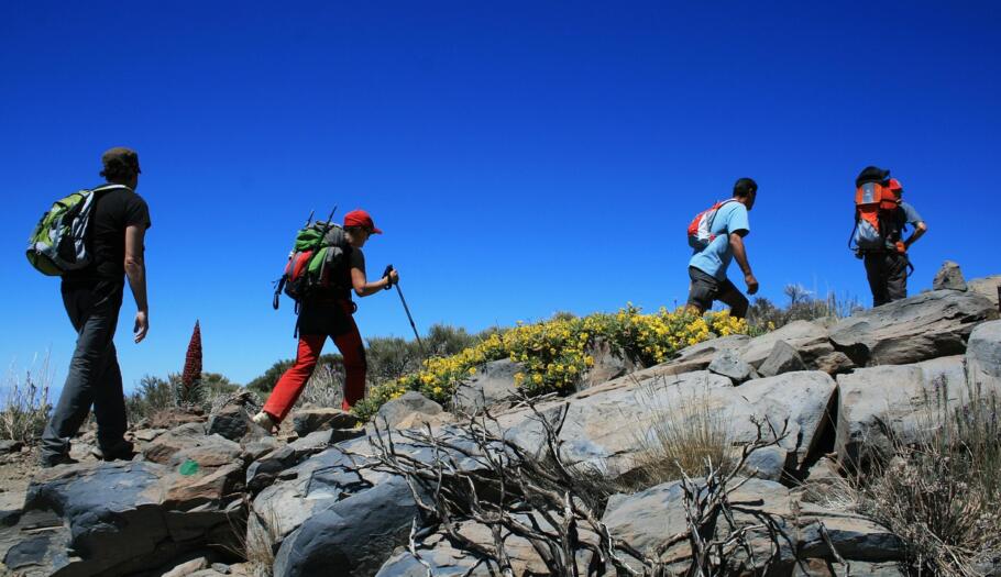
A typical self-guided trip on this route runs seven days: one for arrival, then six consecutive walking days covering roughly 90km (56 miles), with a total ascent of around 15,650ft (4,770m). That figure reflects the trip’s “Challenging” rating — this is a serious mountain crossing, not a gentle countryside walk.
Into the Pine Forests
The walk begins in La Esperanza, a quiet mountain settlement on the edge of the trail’s northern section. From here, the route climbs through the Las Lagunetas pine forest towards El Gaitero (10 miles/16km, 3,540ft/1,080m ascent) — a demanding opening day that sets the physical tone early. The next stage continues through Canary Island pine forest towards La Caldera (9 miles/15km, 3,070ft/935m ascent), where the northern forest meets the historic Camino Real de Chasna and the first real views of Teide National Park start to open up ahead.
Into Teide National Park
From La Caldera, the trail climbs through the Corona Forestal towards El Portillo (13 miles/21km, 3,900ft/1,190m ascent), the gateway into Teide National Park. As the altitude builds, the pine forest thins and finally gives way to open volcanic rock. Arriving at El Portillo is the turning point of the week: everything ahead is the immense, bare caldera of Las Cañadas.
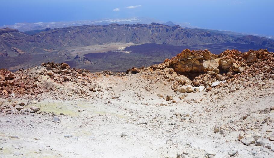
What follows is the trip’s centrepiece: a crossing of the Siete Cañadas on the ancient Camino Real de Chasna, directly beneath Teide’s slopes (8 miles/13km, 1,625ft/495m ascent). Little grows here beyond plants adapted to survive at extreme altitude, and the volcanic rock formations give the plateau an almost otherworldly feel — walkers often describe it as the most dramatic landscape they cross all week. The stage climbs to the Degollada de Guajara, a high pass at around 2,389m, before the long descent toward southern Tenerife begins.
The Descent South
From that high point, the trail drops back through volcanic terrain and into pine forest again on its way to Vilaflor (7 miles/11km, 590ft/180m ascent) — one of Tenerife’s highest villages, and a welcome place to rest after several hard days at altitude.
The final day runs south from Vilaflor through forest, mountain terraces and the settlements around Ifonche, before descending into historic Arona (11 miles/17km, 1,930ft/590m ascent). It’s a long day with substantial descent, and worn-in boots and walking poles make a real difference by this point in the week.
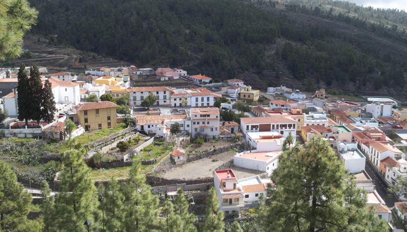
image credits: Daniel Tenerife, https://creativecommons.org/licenses/by-sa/4.0/
How Hard Is It, Really?
This trip carries a “Challenging” rating, and that word earns its place. Several days involve over 3,000ft of ascent, the route touches nearly 2,400m in altitude, and the terrain shifts constantly between forest track, bare volcanic rock and old cobbled trail. You should be comfortable walking for several hours at a stretch over uneven ground, with real elevation gain and loss built into most days.
Weather adds a factor you won’t meet on a lowland trail: conditions at altitude can change quickly, and the route can occasionally be affected by wildfire restrictions or short-notice closures. Proper boots, layered warm and waterproof clothing, sun protection and enough water for long stretches without services all matter here. This isn’t a trip to attempt underprepared — a few months of regular hill walking beforehand, ideally with some sustained climbing, makes a genuine difference to how much you enjoy the week.
(Have a look at some of the neighbouring GR131 Islands)
Two Airports, One Island
Tenerife has two international airports, and which one suits you depends on which end of the walk matters more to you. Tenerife North Airport sits close to the trail’s starting point near La Esperanza, while Tenerife South Airport is nearer Arona, where the walk finishes. From Arona, regular buses run to Tenerife South and the main southern resorts, with onward connections to Tenerife North and Santa Cruz too.
Making the Crossing Easier on Yourself
A route like this asks a lot of your legs. It doesn’t need to ask anything extra of your planning. Maximum Adventure’s Tenerife Volcano Traverse includes six nights in carefully selected accommodation, daily luggage transfers between stops, and a full pre-departure information pack with route notes — so climbing and navigating are the only things you need to think about each day. It runs as a self-guided trip, with 24-hour emergency assistance available throughout, and a qualified guide can also be arranged for all or part of the route if you’d rather not cross the mountain alone.
Frequently Asked Questions
Is this trip suitable for a first long-distance walking holiday? Not really, on its own — it’s rated Challenging rather than Moderate, with sustained daily ascent and high-altitude terrain. It suits walkers who already have some hill-walking experience and reasonable fitness, rather than someone attempting their first multi-day trek.
Do I need to carry my luggage each day? No. Daily luggage transfers are included, so you walk with a day pack only, while your main bag moves ahead to that night’s accommodation.
What’s the best time of year to walk it? This trip runs from October through to June, avoiding the hottest summer months at lower altitude. Because the route climbs to nearly 2,400m, conditions can still turn cold and changeable even outside summer, so pack layers whenever you go.
Is the trail well marked? Yes — it follows the standard European red-and-white GR waymarking used across the Canary Islands’ GR131 network, alongside detailed route notes provided before departure.
Can dogs come on this trip? Generally not recommended, due to accommodation restrictions and the logistics involved along this particular route.
Will I see other walkers on the route, or does it feel remote? Sections through Teide National Park see other hikers, particularly around the more accessible viewpoints, but much of the forest and Camino Real de Chasna sections feel considerably quieter — this isn’t a heavily crowded trail compared with Tenerife’s coastal resorts.
Ready to cross the island on foot? See dates and full trip details for the Tenerife – Volcano Traverse – GR131 – 6 Nights.
Want more information on our self-guided walking holidays? Click here