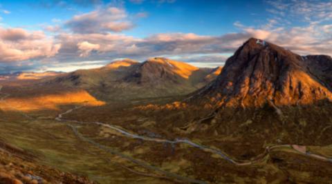
40 Top Mountains in the UK: Your Ultimate Guide and Adventure Checklist
Mountain walking is an exhilarating activity. Hiking provides adventure, awe, and inspiration. It also reduces stress, calms anxiety, and can lead to a lower risk of depression, according to research. On top of this, hiking has been found to even change the brain’s structure, improving cognitive function. Pretty cool, huh?
That’s why we at Maximum Adventure think everyone should be able to access the outdoors safely, whether that’s through mountain hiking, cycling, or trekking, we have a pre-planned adventure waiting for you. Also, check out our blog, where you’ll find supportive advice and inspiration for your outdoor pursuits.
In this article, we wanted to provide you with a complete list of mountains in the UK. We’ll explore 40 beautiful peaks scattered around England, Scotland and Wales. Keep this article handy, print it off even, and treat it as your mountain hike checklist.
Enhance your life with hiking, and let Maximum Adventure be your guide!
- Definition for a mountain
- 40 top mountains in the UK
- Book your mountain hike adventure with Maximum Adventure
Bag packed, boots on, let’s go!
Definition for a mountain
A mountain is an elevation in the earth’s surface, giving a steep rise in the landscape with a defined summit.
Most mountains are formed when Earth’s tectonic plates smash together. The consequences of these collisions can differ but ultimately lead to the formation of mountains. For instance, the edges of these tectonic plates might crumble, one plate might be pushed under another, or the plates grind together. Each different scenario will result in different types of mountain ranges.
The details of how mountains are formed is beyond the scope of this article, but keep your eyes peeled on our blog, as we’ll cover the details of this at a later date!
The difference between hill and mountain
Both terms hill and mountain describe pieces of land that rise higher than their surroundings. How then, do we distinguish the two terms apart?
According to the U.S. Geological Survey, there’s no official difference between hills and mountains. What a conundrum!
For this article, let’s go with the Ordnance Survey’s (OS) arbitrary classification of a mountain vs hill. According to the OS, hills are lumps below 2,000ft (609 metres), and mountains are lumps rising above the magic 2000ft.
This definition seems fitting for the UK’s not-so-towering peaks – when compared to our European neighbours. But that isn’t to say mountain climbing in the UK comes without a challenge. The dangers, technicalities and fitness demands are still present, meaning anyone heading to the UK’s mountain ranges need to be prepared.
Luckily we at Maximum Adventure are here to help you with that. With the right preparation and guidance, mountain walking brings awe, adventure, inspiration and challenge to your life, and is shown to significantly enhance your wellbeing.
I hear you, where do I sign up!
If you’re new to mountain walking, or you’re an experienced mountain goat, you’ll want to know what the best mountains in the UK are to hike. Am I right?
Look no further my friend, as you’ve come to the right place. In this Maximum Adventure article, we’ve listed our top 40 mountains in the UK. Use this list as your UK mountain checklist. But before you get started, be sure to give us a shout here if you need help or advice to prepare for your mountain day, safely.
40 top mountains in the UK
For simplicity, we’ve split our 40 top mountains in the UK between England, Scotland, and Wales.
So get your walking boots on, pack your bag, zip up your waterproof (of course), and let’s get outside and start our mountain escapade.
Mountains in Wales
Your complete list:
- Snowdon
- Tryfan
- Glyder Fawr
- Foel Fras
- Carnedd Llewelyn
- Nantle Ridge
- Cnicht
- Moelwyn Mawr
- Moel Siabod
- Cader Idris
- Aran Fawddwy
- Pen Y Fan
Mountain hike #1: Snowdon
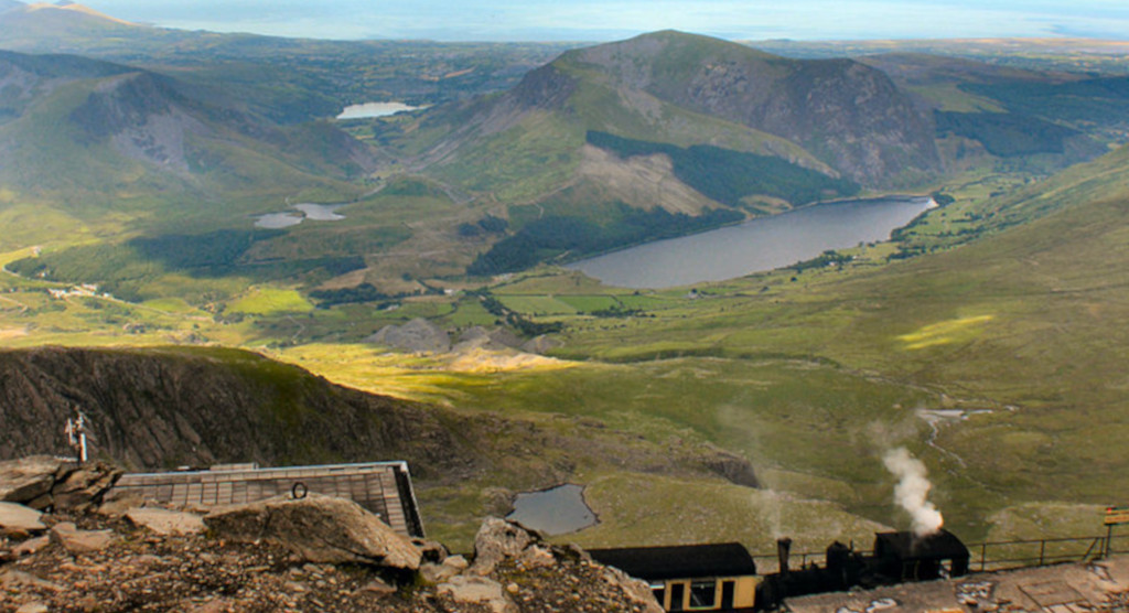
Height: 1085m
We start in Northern Snowdonia, at the highest welsh summit, Mount Snowdon (Yr Wyddfa). Snowdon is the most popular mountain in the UK with over 585,000 visitors each year. This comes as no surprise as the view from the top is voted to be the most spectacular view in the UK. Snowdon is also the last mountain – or first depending on which direction you do it in – in the National Three Peaks Challenge.
Mountain hike #2: Tryfan
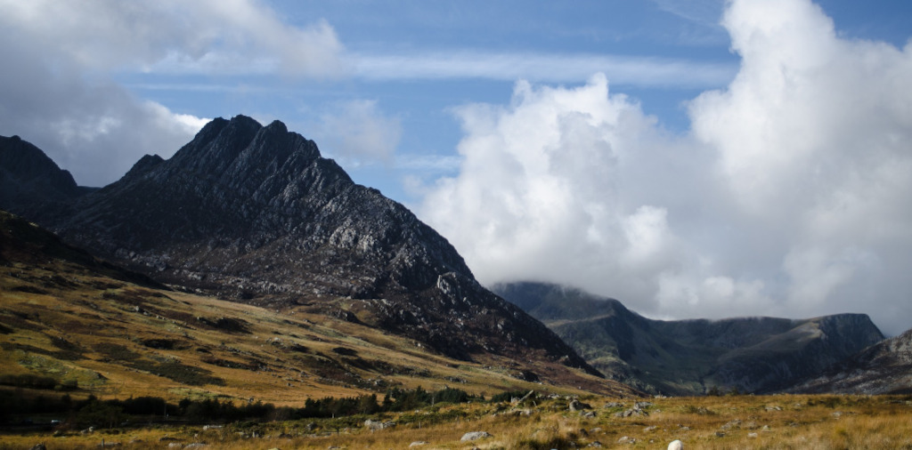
Height: 915m
The Trail Magazine reported Tryfan to be Britain’s favourite mountain. Tryfan isn’t the highest peak, but what this mountain lacks in height, it certainly makes up for in sheer beauty. With its unique geological features, Tryfan (English translation of 3 peaks) captures the heart of many. Be sure to wave to Adam and Eve once you reach the summit.
Mountain hike #3: Glyder Fawr
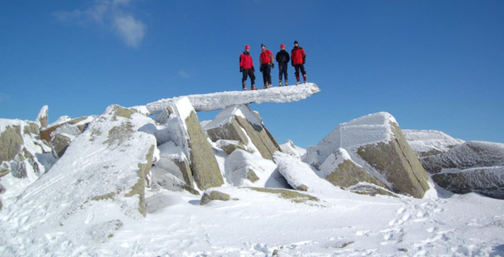
Height: 1,001m
Characterised by jagged rock formations, walking along the summit of the Glyders can feel like walking across some forgotten land. Glyder Fawr is the highest mountain in the Glyderau range. A popular circuit among walkers is to hike Glyder Fawr and its neighbouring sister, Glyder Fach.
Mountain hike #4: Foel Fras

Height: 944m
Foel Fras is a mountain in the Carneddau range, about east of Bethesda, North Wales. Foel Fras has made our list because of the extensive views across Snowdonia and the Conwy coastline. You can also plan a route to the summit through the magnificent Aber Falls, which in themselves, are worth a visit.
Mountain hike #5: Carnedd Llewelyn

Height: 750m
Carnedd Llewelyn is a mountain massif in the Carneddau range, in northern Snowdonia. It’s the highest point of the Carneddau, and the second highest peak by relative height in wales. Regarded as the crown jewel of the Carneddau, walking to the summit of Carnedd Llewelyn gives an epic adventure with extensive views across the Snowdonia national park.
Mountain hike #6: Nantle Ridge

Height: 734m at the highest point (Craig Cwm Silyn)
Okay, we might be cheating a bit on this one. The Nantle Ridge isn’t necessarily a mountain, more a collection of mountains. But it’s too beautiful to not share. The Nantle ridge includes Y Garn (633m), Mynydd Drws-y-Coed (695m), Trum y Ddysgl (709m), Mynydd Tal-y-Mignedd (653m), Craig Cwm Silyn (734m), Garnedd Goch (701m) and Mynydd Graig Goch (610m). The Nantle circuit offers an excellent day walking, with breathtaking views and few crowds.
Mountain hike #7: Cnicht
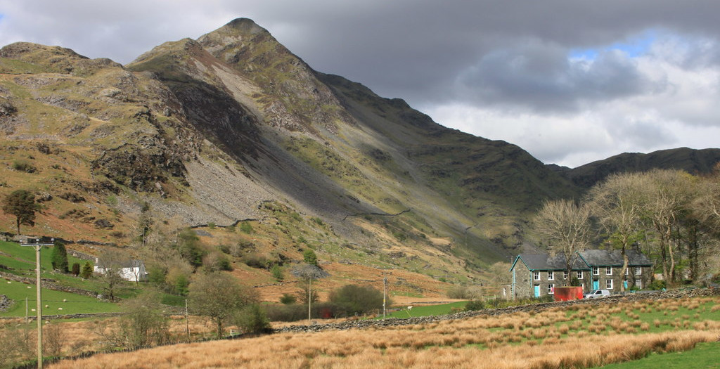
Height: 689m
Cnicht is a mountain in Snowdonia which forms part of the Moelwynion mountain range. Cnicht is nicknamed the Welsh Matterhorn due to its distinctive – yet misleading – shape from the southwest main road. From here, Cnicht looks pointed with sheer faces on either flank. In reality, the summit is the end of a fine ridge, and its pyramidal shape is the cross-section of the mountain. Cnicht is a stunning peak that’s sure to take you away from the crowds.
Mountain hike #8: Moelwyn Mawr
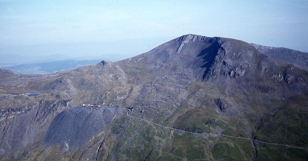
Height: 770m
Moelwyn Mawr (English translation meaning Great White Hill) is part of the Moelwynion range in Snowdonia. This peak has made our list because of its isolation, providing a wild walk. The peak overlooks the valley of Ffestiniog, and the surrounding landscape is steeped in history with remnants of the old slate industry.
Mountain hike #9: Moel Siabod
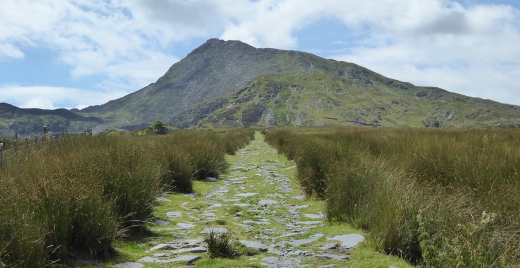
Height: 872m
Moel Siabod is the highest mountain of the Moelwynion range, sitting isolated above the village of Dolwyddelan. The English translation is Shapely Hill, a translation that offers no surprise as you’ll find out on your visit. Moel Siabod is lined with a rich forest at its base which makes for a pleasant walk towards the summit. Be sure to visit the Moel Siabod Cafe for a humungous scone and brew!
Mountain hike #10: Cader Idris
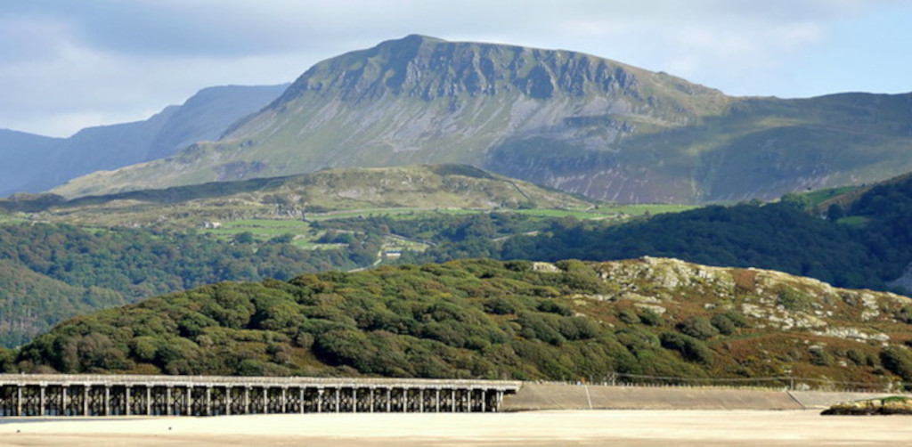
Height: 893m
Cader Idris – otherwise known as Penygader – is a mountain in the historic country of Meirionnydd, Wales, southern Snowdonia. Its peak is very popular among walkers. The mountain has a distinctive shape that is recognizable from miles around, from the coastlines at Tywyn and Barmouth, and high over the market town of Dolgellau. Its summit is sharp compared to the gentler surrounding hills.
Mountain hike #11: Aran Fawddwy
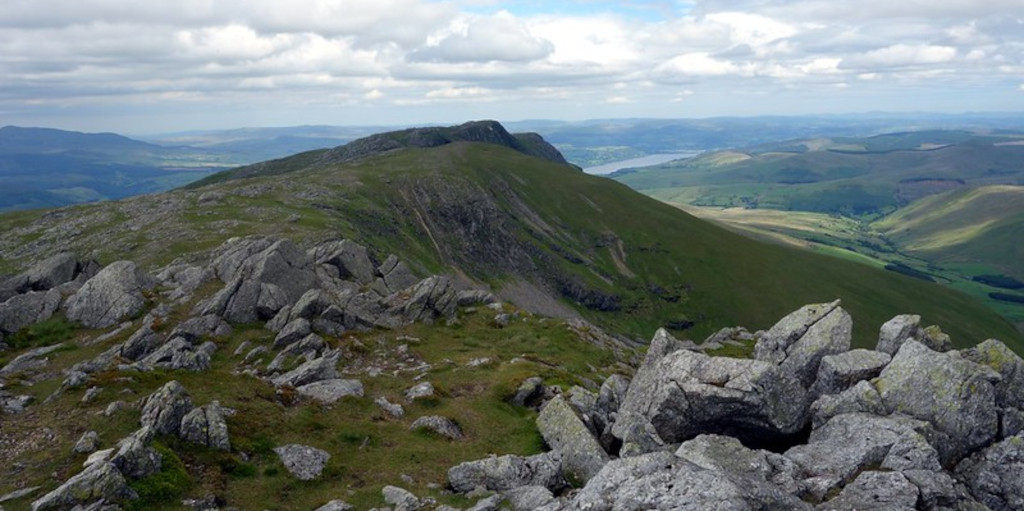
Height: 905m
We’re heading to the Cambrian Range now to visit Aran Fawddwy, the highest mountain here at 905m. Walkers often start in the dramatic Cwm Cywarch, which offers superb scenery with deep valleys and rolling hills. The higher summits of the Aran Fawddwy ridge have a hard, rocky side with distinct grassy slopes enhancing their height. Aran Fawddwy is well worth the punt if you like your mountains to be a little quieter.
Mountain hike #12: Pen Y Fan
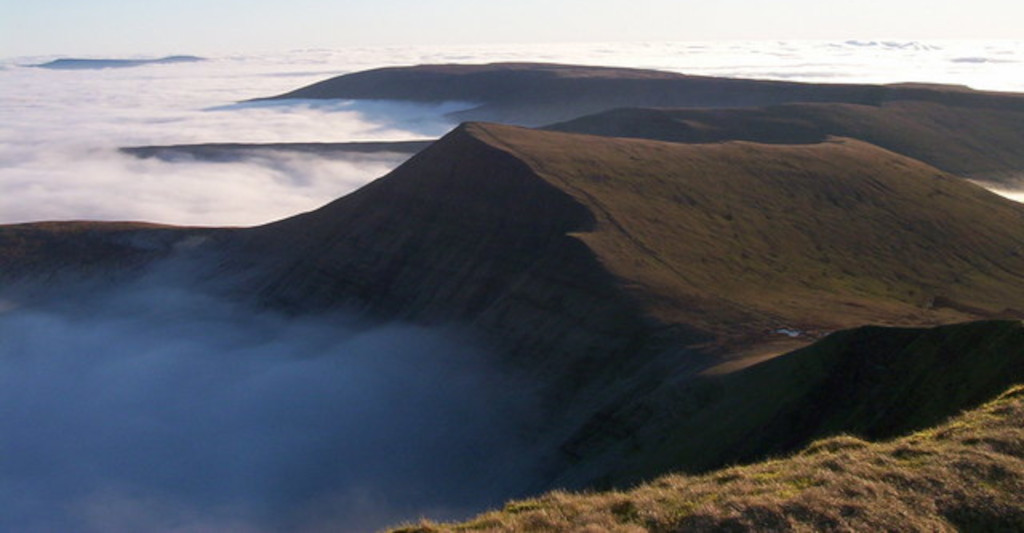
Height: 886m
Pen Y Fan is the highest mountain in southern Wales, situated in the Brecon Beacons which is home to 520-square miles of diverse landscape. On your hike, you’ll walk through grass and heath plateaus, rural woodland, and picturesque waterfalls. Pen Y Fan lures thousands of hikers each year due to its prestigious views over the Brecon Beacons.
Mountains in England
Your complete list:
- Scafell Pike
- Helvellyn
- Great Gable
- Blencathra
- Red Pike
- Old Man Of Coniston
- Cross Fell
- Great Dun Fell
- The Cheviot
- Whernside
- Wild Boar Fell
- The Calf
- High Willhays
Mountain hike #13: Scafell Pike
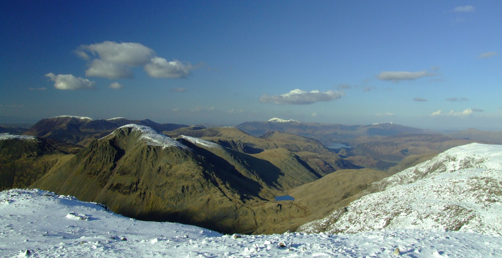
Height: 978m
Scafell Pike is the second mountain on the National Three Peaks Challenge, being the highest and most prominent mountain in England. It’s located in the Lake District National Park, Cumbria, and is part of the southern fells and the Scafell massif. Scafell Pike is not only a mountain, but it’s also a war memorial cared for by the National Trust. Thousands of people flock to this mountain every year. Why not support the volunteer organization Fix the Fells to help manage the footpaths and care for our montane habitats.
Mountain hike #14: Helvellyn

Height: 950m
Helvellyn is the third-highest mountain in the English Lake District, located in the Eastern Fells. Helvellyn has five ridges, giving several routes up to the mountain’s peak. The far eastern side of the mountain gives two dramatic routes up the mountain via the Swirral Edge and the Striding Edge ridge lines.
Mountain hike #15: Great Gable
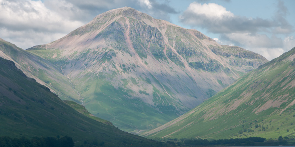
Height: 899m
Great Gable is an impressive peak that towers over Wasdale. This mountain is popular and has many different routes to the summit. For instance, you can ascend the mountain from the surrounding valleys: Wasdale, Eskdale, Brotherdale and Buttermere. Great Gable is named as such due to its pyramidal appearance from Wasdale, though it has a dome shape when seen from other directions.
Mountain hike #16: Blencathra

Height: 868m
Blencathra, also known as Saddleback, is one of the most northerly hills in the English Lake District. It has six separate fell tops, of which the highest is Hallsfell Top at 868m, standing proudly over Keswick. Blencathra was the start of a well-known documentary, Life of a Mountain: Blencathra, which has contributed to the peak’s popularity. There are lots of options to climb this peak. For the experienced walker who’s used to some exposure, you can walk over Sharp Ridge (although we recommend you hire a guide to do this).
Mountains hike #17: Red Pike
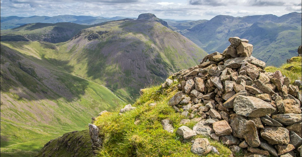
Height: 755m
Red Pike is a fell in the High Stile range in the west-side of the English Lake District. The mountain separates Ennerdale from the valley of Buttermere and Crummock Water. Lots of people walk the ridge from Red Pike to Haystacks, which gives excellent views of the Scafells, Great Gable and Pillar.
Mountain hike #18: Old Man of Coniston
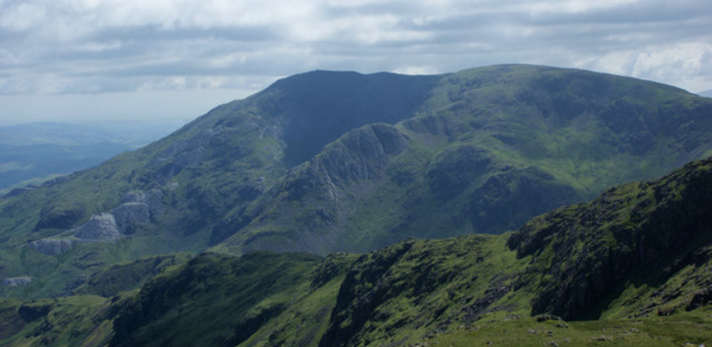
Height: 802m
The Old Man of Coniston is located in the Furness Fells in Cumbria, lying to the west of the Coniston village and lake. This gives a picturesque walk with tarns, sweeping valleys and remnants of the old copper mines. There are several routes to the summit, but the most popular tracks include the Low Water Route (heading north from Walna Scar) and the Goat’s Water Route (heading west from Walna Scar).
Mountain hike #19: Cross Fell
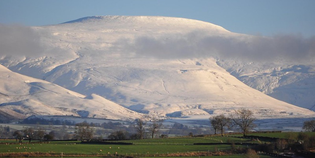
Height: 893m
We’re travelling away from the English Lake District now to arrive at Cross Fell. This is the highest mountain in the Pennine Hills of Northern England, and the highest point in England outside the Lake District. The Pennines are a major upland mass forming a spine in the north of England that extends from Northumberland, southward into Derbyshire. Cross Fell is a broad-based, bulky Pennine peak. The rock summit provides an epic view of the Pennines when visited on clear days.
Mountain hike #20: Great Dun Fell
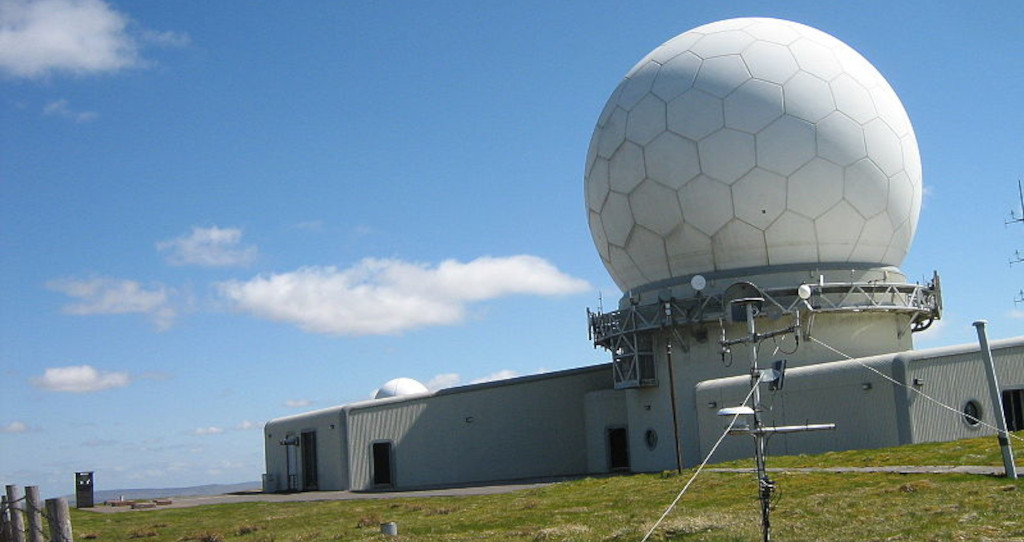
Height: 842m
We remain in the English Pennines to arrive at Great Dun Fell, which is the second highest mountain in the Pennine range. The mountain is situated two miles south along the watershed from Cross Fell. The summit hosts a radar station, which is a key part of the Air Traffic Control system for Northern England and Southern Scotland. Building this radar station required the repaving of a tarred road to the summit, which became Britain’s highest road. With this, Great Dun Fell is sure to provide you with a unique mountain experience.
Mountain hike #21: The Cheviot

Height: 815m
We arrive in another region of England, the Northumberland National Park. This is the northern-most national park in England, covering an area of more than 1,050 square kilometres. The national park extends between the Scottish border in the north, to just south of Hadrian’s Wall. The Cheviot is an extinct volcano in this region, and the highest summit of the Cheviot Hills and the Northumberland county. Climbing the Cheviot gives a lovely Anglo-Saxon walk.
Mountain hike #22: Whernside
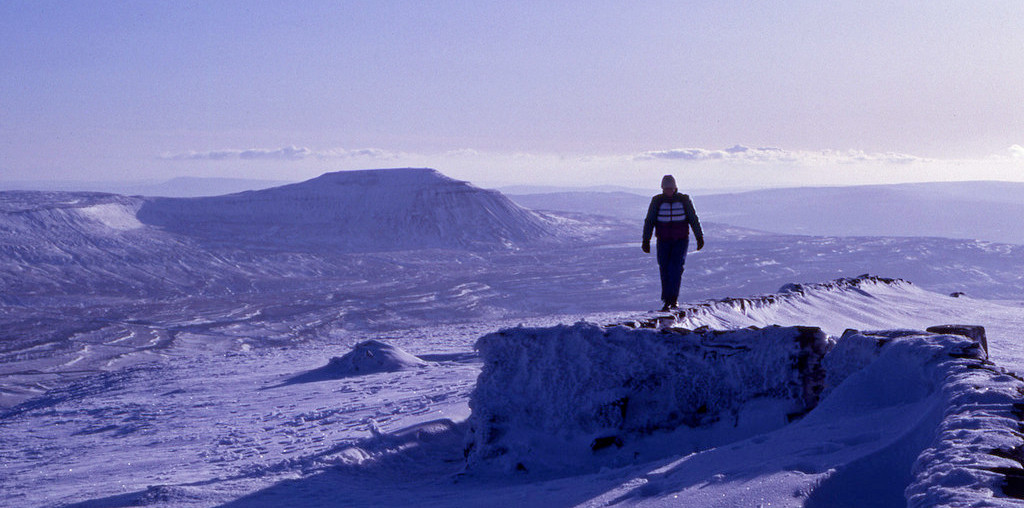
Height: 736m
Moving from Northumberland, we come to the Yorkshire Dales in Northern England to explore the mountain peaks there. Whernside is the highest of the Yorkshire Dales three peaks, the other two being Ingleborough and Pen-y-Ghent. Why not take the Yorkshire Three Peaks Challenge to conquer all three mountains in one hit? Whernside is one of the most famous of the three peaks in Yorkshire and worth the climb.
Mountain hike #23: Wild Boar Fell
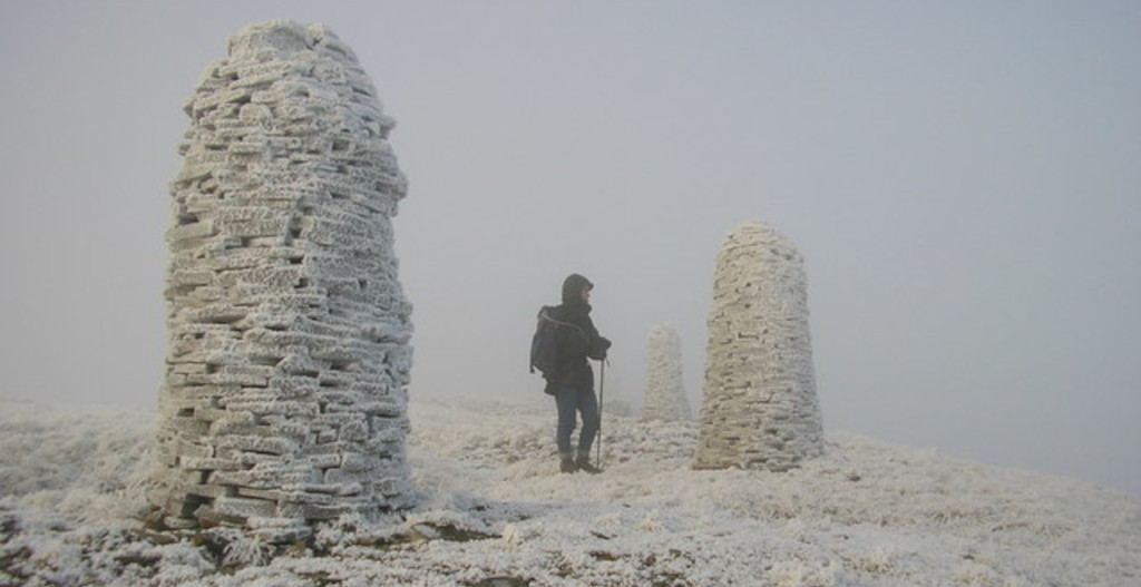
Height: 708m
Wild Boar Fell, another mountain in the Yorkshire Dales, is worth the extra effort while you’re there on your Yorkshire Three Peaks Challenge 😉. Wild Boar Fell is on the eastern edge of Cumbria England and is the 4th-highest fell in the Yorkshire Dales. You can look out on the southern side to view the Yorkshire Three Peaks with a distinctive profile of Ingleborough. This fell is appropriately named as it’s reported to be the place where the last wild boar in England was shot in the 15th century.
Mountain hike #24: The Calf

Height: 676m
We’re moving to a different part of Northern England now, to the Howgill Fells, which can be found between the Lake District and the Yorkshire Dales. The Calf is the highest point in this region and is usually ascended from the town of Sedbergh. During the spring, this walk is great for the Botanist in you, featuring beautiful wildflowers.
Mountain hike #25: High Willhays
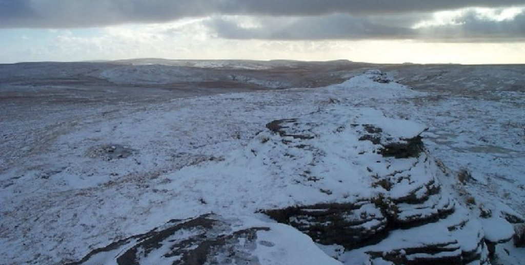
Height: 621m
Next, let’s travel south to Dartmoor in Devon. High Willhays is the highest point in this region and the highest point in southern England overall. The terrain can be boggy after wet weather, but the walking isn’t particularly difficult. Explore the beauty of Dartmoor, a wild landscape to escape in from the humdrum of modern life.
Mountains in Scotland
Your complete list:
- Ben Nevis
- Aonach Beag
- Buachaille Etive Mor
- Bidean nam Bian
- Ben Lomond
- The Cobbler
- Ben Macdui
- Cairn Gorm
- Ben Lawers
- Suilven
- Cùl Mor
- An Teallach
- Ruadh Stac Mor
- Inaccessible Pinnacle (Sgùrr Dearg)
- Bruach na Frithe
Mountain hike #26: Ben Nevis
Height: 1,345m
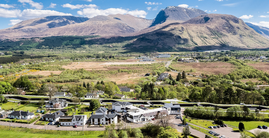
Ben Nevis is a mountain that needs no introduction. It’s the highest mountain in the UK, towering above Fort William as part of the Grampian Mountain range. The peak attracts nearly 125k walkers every year.
Did you know that Ben Nevis was once an active volcano? Today Nevis’s volcanic activity lies dormant, but the remnants of its fiery past can be seen at the summit where there’s a form of light-coloured granite. Why not book your guided Ben Nevis summer ascent with Maximum adventure. Or you can take on a greater challenge and complete the mountain in winter, learning winter mountain skills with our Ben Nevis Winter Guided Training and Ascent trip.
Mountain hike #27: Aonach Beag
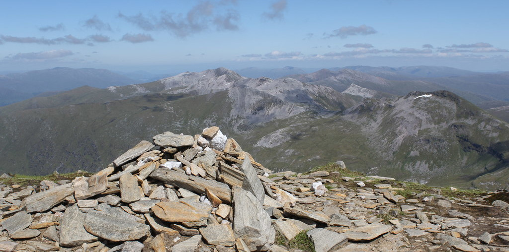
Height: 1,234 m
As you stand on top of Ben Nevis, you can look out towards its neighbor Aonach Beag. Instead of looking at this mountain, why not make the effort to climb it. The easiest way up is to take the gondola lift that serves the Nevis Range ski area on Aonach Mòr. This high and rugged mountain gives a rewarding mountain hike, taking you away from the crowds on Ben Nevis.
Mountain hike #28: Buachaille Etive Mòr

Height: 1,021m at the highest point (Stob Dearg)
Buachaille Etive Mòr is a stunning peak that contributes to the awe and beauty of the Glencoe valley. The peak has a unique pyramidal shape that can be seen from the A82 road that runs through Glencoe. Its prominence and spectacular features make this a mountain that’s often depicted on postcards and calendars. Buachaille Etive Mòr forms a ridge that’s five miles (eight km) in length, and it’s almost entirely encircled by the River Etive. The ridge contains four titled high points, named (from north-to-south) Stob Dearg (1022m), Stob na Doire (902m), Stob Coire Altrium (941), and Stob na Broige (956m).
Mountain hike #29: Bidean nam Bian

Height: 1,150m
Bidean Nam Bian (otherwise known as the three sisters), like Buachaille Etive Mòr, is more of a mountain range than a peak. It’s a huge and complex mass of dramatic crags, ridges, and summits. The most noticeable feature of Bidean nam Bian is the famous Three Sister peaks. Two of these sister, Gearr Aonach and Aonach Dubh converge at Stob Coire nan Lochan at 1,115m. The final sister, Beinn Fhada joins Bidean nam Bian massif at the summit of Stob Coire Sgreamhach. Many beautiful routes head up these peaks, giving incredible views across the valley and around Glencoe.
Mountain hike #30: Ben Lomond

Height: 974m
We’re travelling from the Western highlands now to the Southern Highlands, coming to Ben Lomond – another popular peak. Ben Lomond’s smaller height doesn’t detract from the peak’s popularity. Lomond is a southerly mountain that can be climbed from Rowardennan and gives breath-taking views over Lock Lomond and The Trossachs National Park. Look out for wildlife including Ptarmigan, Ravens, Skylarks, Wheatears, and Black Grouse.
Mountain hike #31: The Cobbler
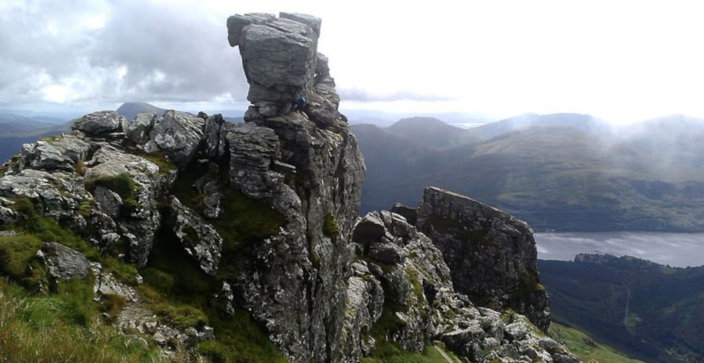
Height: 884m
The Cobbler, otherwise known as Ben Arthur, is situated in the Arrochar Alps. It’s not the highest mountain of Scotland, but what this peak lacks in height, it makes up for in awe. The Cobbler is named after its large rocky summit features, which are supposed to represent a cobbler bending over his last – a tool used by Cobblers that’s shaped like a foot. The cobbler has three summits, the middle one being the highest, which looks out over the head of Loch Lomond.
Mountain hike #32: Ben Macdui

Height: 1.309m
Moving out of the Southern Highlands, we come to the Cairngorm mountains. Here we find the second-highest mountain in the UK, named Ben Macdui. Ben Macdui lies on the southern edge of the Cairngorm plateau. Macdui is an isolated peak standing high above the wild plateau of the Cairngorms, with spectacular views and the chance to spot Mountain Hares, Ptarmigans and Red Deer on a fine day.
Mountain hike #33: Cairn Gorm

Height: 1,245m
Cairn Gorm is another extremely popular peak in Scotland. Granted it’s not the highest, yet its popularity stems from the mountain’s location, being a prominent peak in the Cairngorm mountain range. Cairn Gorm has been developed for skiers and therefore hosts a funicular railway up to the Ptarmigan Restaurant at the summit. The high, broad domed summit overlooks Strathspey and is one of the most identifiable mountains from the nearby town Aviemore.
Mountain hike #34: Ben Lawers

Height: 1,214m
From the Cain Gorms, we can move into the Central Highlands, to the highest peak named Ben Lawers, which is again another popular attraction. This peak is home to some of the rarest arctic-alpine plants in Britain, such as the Alpine Mouse-ear, the Purple Saxifrage and the Bristle Sedge. As such, this peak has been designated a National Nature Reserve since the 60s. The mountain is at the centre of a chain of other high peaks, giving the fit walker a challenging day out.
Mountain hike #35: Suilven

Height: 731m
Travelling from the Central Highlands to the Northern Highlands we arrive at a much smaller, but unique peak named Suilven. The English translation for this mountain is Pillar Mountain, as the peak rises from the wilderness landscape of moorland, bogs, and lochans, in the Inverpolly National Nature Reserve. There are two other summits on Suilven: Meall Meadhonach (Middle Round Hill) and Meal Beag (Little Round Hill) at the central point and south-eastern end respectively.
Mountain hike #36: Cùl Mor
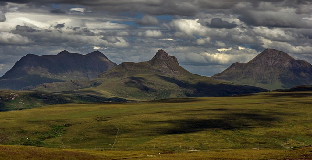
Height: 849m
Cùl Mor is a twin-summited mountain that lies in the northwest of Scotland. This is again an isolated peak that can be accessed using old stalker paths and easy green lines. The hills lie in the beautiful lost valley which holds a lochan and a beach. Cùl Mor boasts a shapely summit with bands of weathered sandstone cliffs. These cliffs limit the possible ascent routes. Cùl Mor can be climbed along with its neighbouring mountain, Cul Beag.
Mountain hike #37: An Teallach
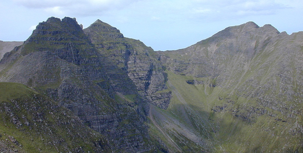
Height: 1,062m
An Teallach is a peak that lies close to Cùl Mor, situated to the southwest of Dundonnel, and overlooking the Little Loch Broom. An Teallach is mostly made up of sandstone. The peaks sides are calved with steep gullies, pointing towards the sharp rocky summits. This is another complex mountain massif, with ten distinct peaks, the highest being Bidean a’ Ghlas Thuill.
Mountain hike #38: Ruadh Stac Mor
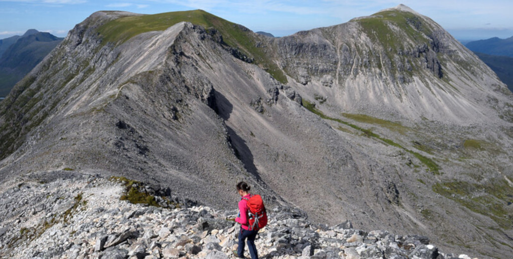
Height: 919m
The Dundonnell and Fisherfield forest cover a large part of a mountainous area called Wester Ross in the Scottish Northwest Highlands. This mountain has made our list because of its remote position, and the views this peak grants on the summit. Standing on top of Ruadha Stac Mor, you can look out across Dundonnell and the Fisherfield Forest.
Mountain hike #39: Inaccessible Pinnacle (Sgùrr Dearg)

Height: 986m
We thought we’d finish our mountain tour on the Isle of Skye. Here we come to a very popular peak named the Inaccessible Pinnacle (Sqùrr Dearg), which lies on the infamous Cullin Ridge. The mountain is legendary among mountaineers due to its exposed peak. On the summit lies a fin of rock measuring 50 metres (150 feet) along its longest edge. This is the only mountain in Scotland with a peak accessible only via rock climbing. For those of you who aren’t experienced climbers, book a guided ascent. The effort will be well worth it, giving your views over Glen Brittle and across Loch Brittle.
Mountain hike #40: Bruach na Frithe

Height: 985.8m
If you’re looking for an easier and less technical route up on the Cullin Ridge, then Bruach na Frithe is the mountain for you. This peak is one of the principal summits on the Black Cullin ridge, and like the rest of the range, it’s composed of gabbro. The simplest route ascends via Fionn Coire, although there’s a slightly more challenging Northwest Ridge route. The summit of Bruach na Frithe gives one of the best viewpoints across the Cullin.
Book your mountain hike tour with Maximum adventure
There you have it, our top 40 list of mountains in the UK. I bet you’re itching to get started right?
Why not book your mountain ascent with us at Maximum Adventure. Let us be your guide and ensure your safety, enjoyment, and that your trip runs smoothly. Whether you want to scale Ben Nevis, book your Yorkshire Three Peak Challenge, or you want to explore Lakeland mountains, Maximum Adventure will help you with your aim. We like to think we can fulfil any adventure request, so get in touch, and start scaling the mountains on your doorstep.
What’s your favourite mountain in the UK? Is there a mountain we haven’t mentioned here you think needs a special shoutout? Get in touch and let us know. We’re always happy to hear from you!


